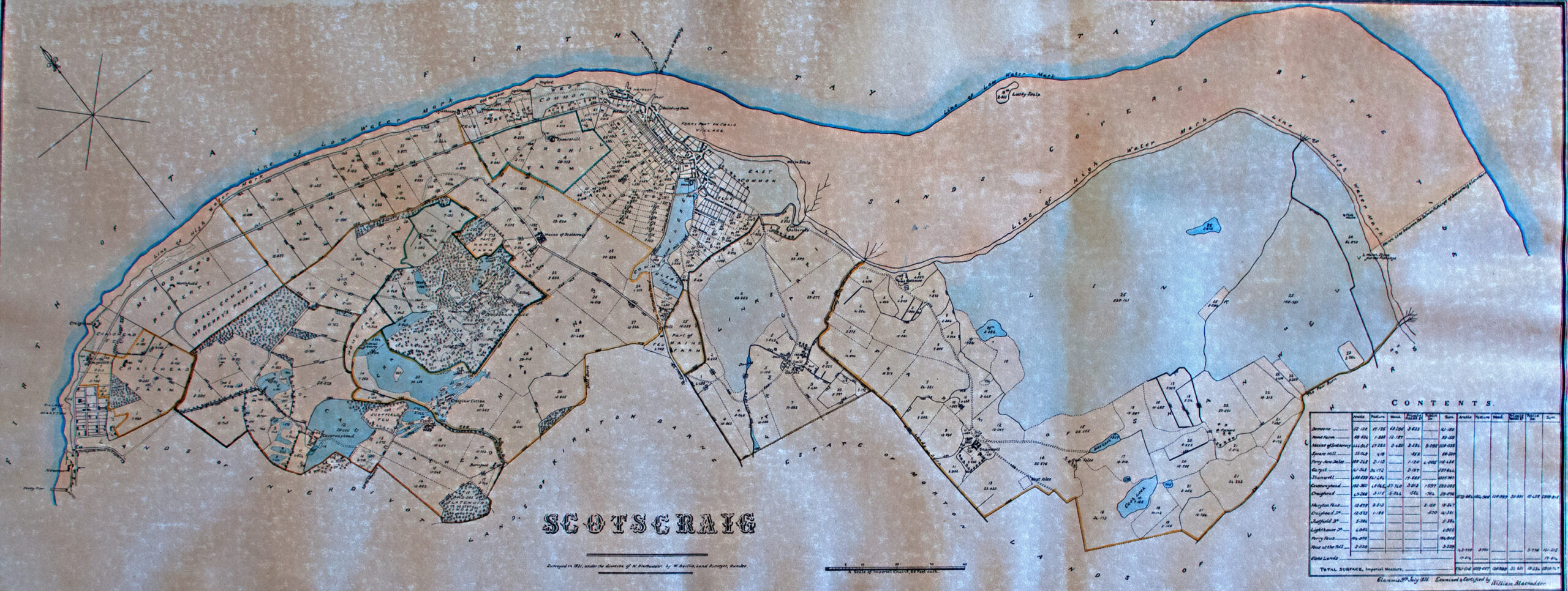
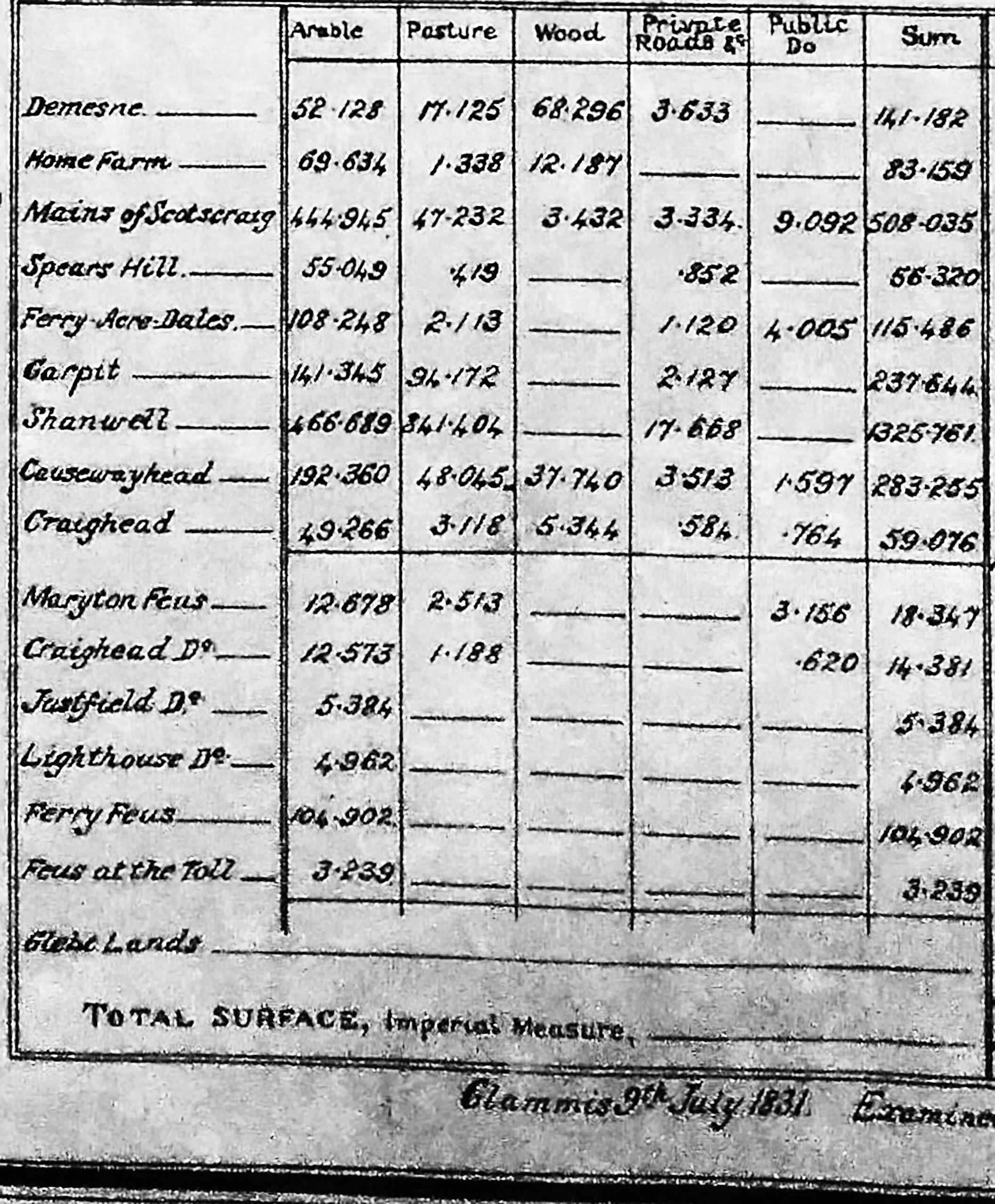
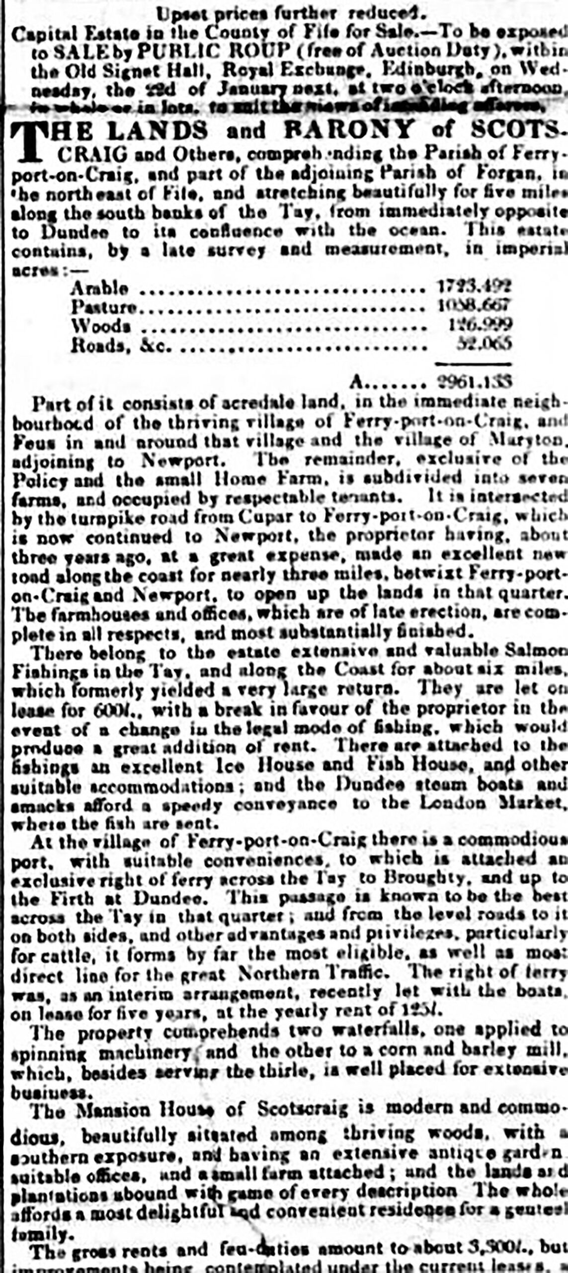
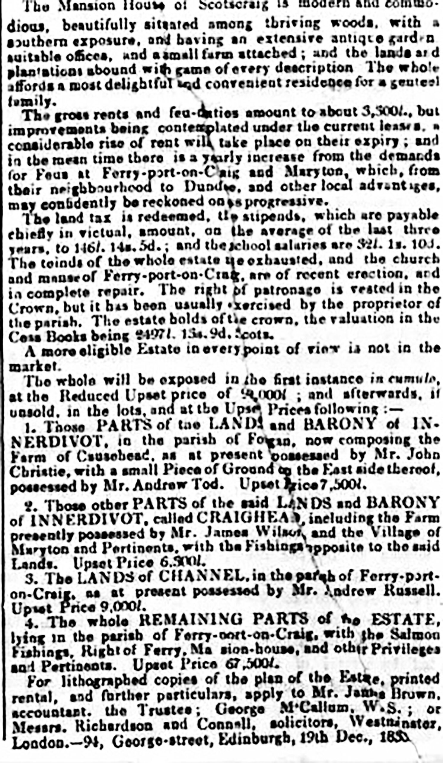
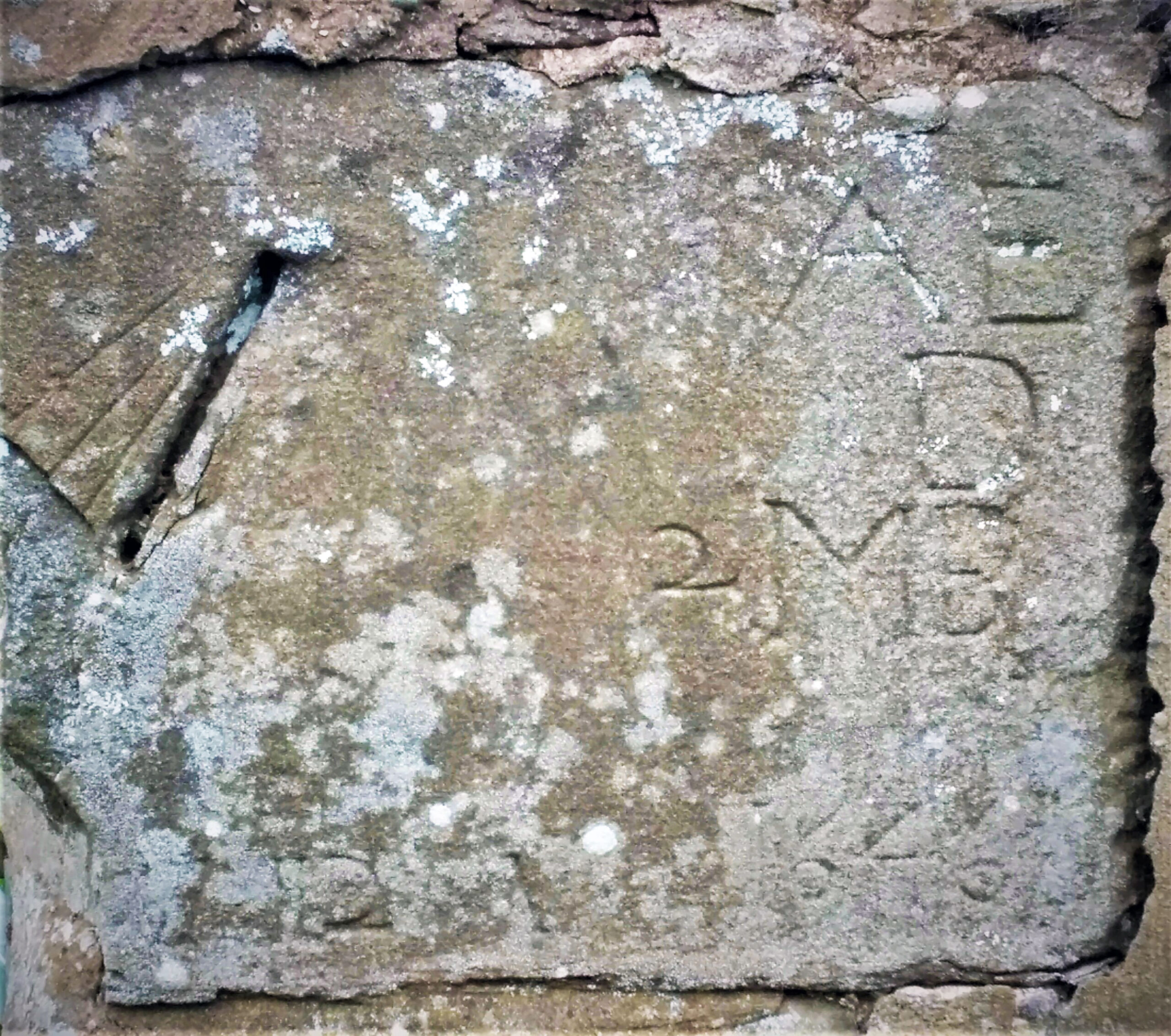
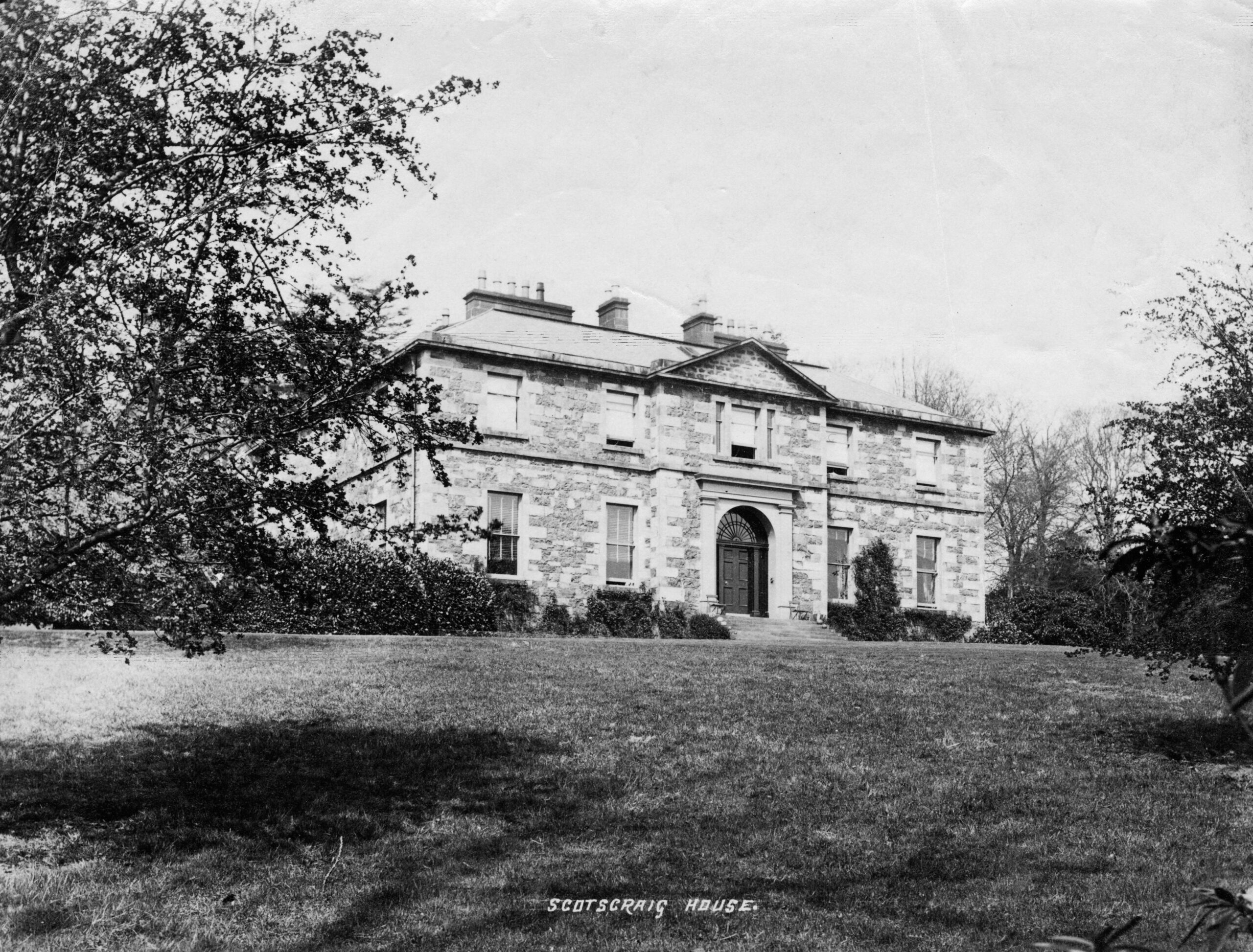
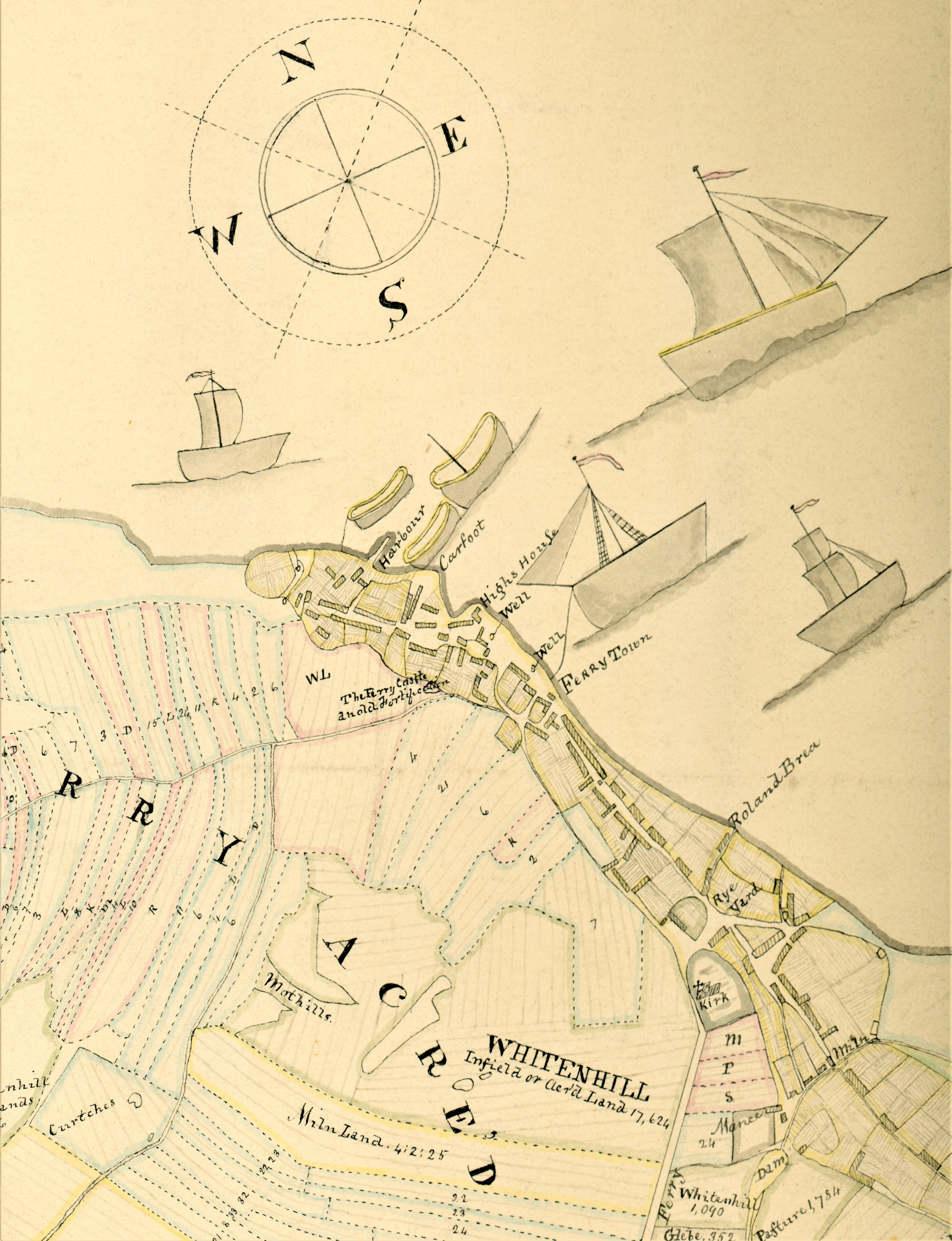
The Estate of Scotscraig has an intriguing history as A H Millar (1895) advises, with dubious authority, that the estate was feued in 1240 during the reign of Alexander II, by one of the bishops to Sir Michael Scott of Balwearie, the father of Michael Scott the wizard. It also passed to the Duries, the Ramsays, the Buchanans, the Erskines by marriage, the Sharps and the Colvilles. The Dalgleish family, who were related to the Colvilles through marriage, took over the estate circa 1728 and fulfilled a major role in the area for at least four generations. In 1834 the Barony of Scotscraig estate was bought by the Dougall family, whilst the lands of Maryton, Causewayhead and Craighead in the Barony of Innerdivot (sic) within the parish of Forgan, were purchased by the Berrys of Tayfield. Admiral William Heriot Maitland a grandson of William Dalgleish, married into the Dougall family in 1851 and adopted the name Maitland Dougall.
The trustees of the Maitland Dougall family in turn sold the estate to the City of Dundee in 1918. It is reported the city had expansion aspirations from an industrial perspective, which fortunately did not come to fruition. In 1924 Dundee Council sold by public roup, the 811 acres which consisted of the mansion house and grounds, the farms of Scotscraig Mains and Burnside to James Colville Henderson whose family ownership continued for the following 55 years. The sale in 1924 also included the Shanwell Farm of which the 1200 acres forming part of the Shanwell Links and Easter Fetters area of Tentsmuir, was bought by the Forestry Commission. The farm of Scotscraig was subsequently bought by the Lamont family in 1979. At the time of the formation of the parish, Sir John Buchanan and his wife Margaret Hartsyde who gained some notoriety from her role as an aide to Queen Anne, had their coat of arms incorporated on the Auld Kirk steeple along with his daughter Margaret and her husband Sir Arthur Erskine, who became the laird when Sir John died in 1644. He took over when the country was in the throes of Civil War during the Wars of the Three Kingdoms 1638-1660 in the time of Charles I who had introduced his Book of Common Prayer in 1637. This created divisions which resulted in the Covenanters signing the National Covenant in 1638. In the absence of the Earl Marischal, J Scott (1927) advises “ Arthur Erskine of Scotscraig who was depute Keeper of the Regalia of Scotland in 1650, was instructed to keep and transport them as the Committee of Estates gave directions”.
“In the Parliament held at Perth on the 26th November 1650, Arthur Erskine again presented the Crown, Sceptre, and Sword, and at the close of the sitting these emblems were delivered to Scotscraig for safe keeping in the name of Earl Marchell.” Sir J. Scott goes on to advise that Erskine further presented them on 30th December 1650 and to the Coronation of Charles II at Scone on 1st January 1651. Erskine was killed at the battle of Worcester in September 1651 by the forces of Oliver Cromwell, at a time when major divisions within the country were still prevalent. At that time he was leading his Covenanter Scotscraig’s Regiment of Horse (1649-1651) whereas previously he had led his Scotscraig’s the Ministers’ Regiment of Foot, forming part of Leven’s army in England during 1643-1646 (Stuart Reid 2012- Crown Covenant and Cromwell 1639-1651). Arthur was succeeded by his son John who held the estate until it was sold in 1667.